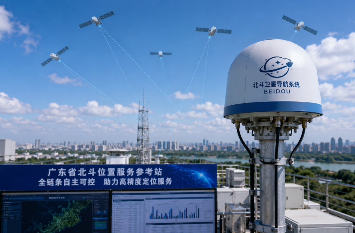
China's satellite navigation infrastructure just cleared a significant milestone. The Guangdong independent BeiDou positioning reference service - a province-wide network that doesn't rely on any foreign components, software, or data pipelines at any point in its chain - has passed official scientific and technological evaluation. Led by the Guangdong Provincial Institute of Land Resources Surveying and Mapping, with contributions from Wuhan University, South China Agricultural University, Southern Surveying and Mapping, and other institutions and enterprises, this is being recognized as a pioneer-level technical achievement.
And if you're watching how China is building out sovereign digital infrastructure, this one's worth understanding properly.
What the Guangdong Independent BeiDou Positioning Reference Service Actually Achieved
Most people assume that using BeiDou signals automatically means "independent." It doesn't. Until recently, regional reference networks in China still depended on foreign chipsets inside reference stations, overseas software for signal correction, or third-party data streams for accuracy enhancement. Any of those dependencies creates a single point of failure - technical or geopolitical.
What the Guangdong Provincial Institute of Land Resources Surveying and Mapping built is different. Every layer runs on domestically developed technology. The hardware. The processing algorithms. The correction data generation. The transmission protocols. That's what makes this a genuinely full-chain independent BeiDou positioning reference service, not just one that uses BeiDou satellites as an input.
This connects directly to why China tech sovereignty rules have been tightening across tech sectors. Positioning infrastructure sits at the foundation of land administration, autonomous logistics, and smart city sensing. If any part of it can be disrupted by an external actor, it's not actually secure.
How Guangdong Achieved Full-Chain Independent BeiDou Positioning Reference Service
The Wuhan University satellite positioning research collaboration was central to this. Not in a ceremonial way - Wuhan University brought the algorithmic expertise needed to solve genuinely hard problems in real-time high-accuracy positioning.
Getting centimeter-level accuracy - under three centimeters, which is what precision applications actually require - demands solving atmospheric delay correction, multi-path signal error in complex terrain, and timing synchronization across a province-wide station network simultaneously. None of that is trivial. The key technologies and applications of fully independent BeiDou developed through this project tackled those problems using domestically built methods, which is why the Southern Surveying and Mapping technological achievement evaluation classified this as a scientific and technological achievement rather than a routine system integration project.
South China Agricultural University smart precision farming requirements shaped a lot of the practical specifications. Sub-centimeter guidance for autonomous farm machinery is demanding - standard GPS accuracy isn't remotely sufficient, and the network needs to stay stable under tree cover, humidity variation, and irregular terrain. Getting that right meant building new integration frameworks between reference station data and field applications from scratch.
One thing that often gets overlooked: reference station hardware needs chips. Capable ones. If those chips come from foreign suppliers, the "independent" claim collapses immediately. That's why the push toward domestic semiconductor self-sufficiency isn't a separate story here - it's part of the same infrastructure sovereignty logic.
Why Independent Satellite Reference Networks Are Critical for Regional Digital Infrastructure
Regional positioning networks that depend on foreign components can fail in ways that aren't predictable or locally controllable. A licensing dispute, an export restriction, a technical discontinuation - any of those can cascade into disruptions for every system built on top of the positioning layer. And those systems now include drone delivery corridors, autonomous vehicle testing routes, smart agriculture machinery, and municipal sensor networks.
The failure modes are different. And harder to mitigate.
The autonomous spatial entity data files management regulations that Guangdong is rolling out assume high-accuracy, always-available positioning data. So do the low-altitude economy infrastructure surveying tools that support drone logistics planning. When the province-wide independent satellite positioning network is the foundation, those applications can be planned with confidence rather than worked around. Smart city digital infrastructure increasingly depends on exactly this kind of stable, high-accuracy positioning layer - traffic management, construction monitoring, and utility mapping all benefit from reference station accuracy measured in centimeters, not meters.
Real Applications Opening Up Now
So what actually gets built on this network?
Drone logistics is probably the most immediately visible. How fully autonomous positioning reference services benefit drone logistics in South China is now answerable with real infrastructure. Corridor planning for delivery routes, real-time route correction, and airspace deconfliction all require the precision and reliability that only a trusted domestic reference service can guarantee. Combined with the broader push toward an advanced autonomous driving chip ecosystem, the technical stack for autonomous mobility is coming together in Guangdong faster than most observers expected.
Precision agriculture is arguably the larger application at scale. BeiDou positioning applications in South China farming systems now have a reference service that can reliably support sub-centimeter guidance for autonomous machinery - variable-rate input application, auto-guided field operations, and yield mapping with the accuracy that makes "precision agriculture" actually precise rather than marketing language.
Surveying and land administration are the original use case. The Guangdong Provincial Institute of Land Resources Surveying and Mapping didn't build this system for abstract reasons. A fast-developing province with complex land-use dynamics needs constant, accurate spatial data. The Southern Surveying and Mapping evaluation confirmed the system meets the standards required for that kind of deployment.
Where This Fits China's Larger Tech Picture
This isn't a standalone project. It's one piece of a pattern.
China's satellite launch milestones have been accelerating, expanding the BeiDou constellation that ground-based reference networks draw from. Space computing innovation is reshaping how satellite data gets processed and applied in real time. Orbital data center capabilities are blurring the line between space infrastructure and ground infrastructure in the positioning data pipeline. And reusable rocket engine progress is lowering the cost of maintaining and expanding the constellations that make precision reference services possible in the first place.
Meanwhile, 6G and AI connectivity standards being finalized at international forums now treat high-accuracy positioning as a core component of next-generation mobile networks, not an optional add-on. The spatiotemporal intelligent information industry white paper 2026 frames regional positioning infrastructure as foundational to the spatial data economy. Guangdong's achievement is evidence that the technical foundation is ready for that next layer to be built on top of it. And future mobile positioning tech will depend on exactly this kind of trusted, domestically controlled reference layer to deliver on its accuracy promises.
Key Takeaways
The Guangdong independent BeiDou positioning reference service passing official evaluation closes the proof-of-concept phase and opens the deployment phase. A province of 130 million people, significant industrial complexity, and ambitious digital infrastructure goals now have a positioning backbone that depends on no external system.
The Wuhan University satellite positioning research collaboration solved the hard algorithmic problems. South China Agricultural University's smart precision farming requirements shaped the practical specs. Southern Surveying and Mapping's evaluation confirmed it's deployment-ready.
Watch what gets built on top of this network over the next few years. That's where the story gets interesting.